Pedal to the Limits: Discover Bavaria's Outer Rim
Friday, August 22 2025 - First day: LA
Start in Munich at 8, restart in Garching at 3.30pm. This time I took the Isarradweg and not the shortcut via MUC airport. 6pm in LA, the camp site full, but some space for a small tent was available.


Landshut - Mr Seiler wanted a praise of his hometown in my blog
In Landshut, wo die Isar leise zieht,
und über Türme gold’ner Glanz sich gießt,
begrüßt die Burg aus längst vergang’ner Zeit
den Wanderer in stolzer Herrlichkeit.
Die Landshuter Hochzeit, ein Fest so groß,
erzählt von einer Liebe – innig, makellos.
Doch nicht nur Liebe, auch das Bier ist hier bekannt,
wohl eines der besten im ganzen Bayernland.
Die schönsten Mädchen, voller Anmut, Glanz,
verzaubern die Herzen beim fröhlichen Tanz.
Und Bratwürste, saftig, gewürzt und fein,
laden zum Schmausen und Genießen ein.
Oh Landshut, Perle an der Isar Strand,
bewahrt und geformt von Menschenhand.
In dir vereint sich Altes mit dem Neu’n –
ein Ort voll Zauber, wo Träume gedeih’n.


Saturday, August 23 2025 - LA to Bavarian Forest
Early on the bike, Isarradweg for many kilometers, Coffee and a Nusschnecke 3.75+2.50 euros, I want my prices from Spain back. Vilsradweg, Vilshofen at noon and via Passau into Bavarian Forest. Campsite with a view.


Passau
Passau, known as the "City of Three Rivers," is located in Lower Bavaria, Germany, where the Danube is joined by the Inn and Ilz rivers. The city has a population of approximately 50,000, with a significant portion being students at the University of Passau, which is renowned for its programs in economics, law, theology, computer science, and cultural studies. Historically, Passau has roots dating back to the 2nd century BC when the Boii tribe established a settlement there after being displaced by the Romans. The city was also a Roman colony known as Batavis, serving as a military post in the provinces of Raetia and Noricum.
Throughout its history, Passau has been a significant religious and cultural center. In the 5th century, St. Severinus founded a monastery, and in 739, the diocese of Passau was established by Archbishop Boniface, becoming one of the largest dioceses in the Holy Roman Empire. The city played a role in the Protestant Reformation, with the Treaty of Passau in 1552 leading to the Peace of Augsburg. During the Renaissance, Passau became a hub for sword manufacturing, with its blades gaining fame for their supposed magical properties. The city was rebuilt in the Baroque style after a devastating fire in 1662 and underwent significant political changes in the early 19th century when it was divided between Bavaria and Salzburg.
In modern times, Passau has faced challenges such as severe flooding in 2013 due to its location at the confluence of three rivers. The city is a popular tourist destination, known for its gothic and baroque architecture, including St. Stephen's Cathedral, which houses one of the largest church pipe organs in the world. Passau's historical and cultural attractions, such as the Veste Oberhaus fortress and the Old City, draw visitors interested in its rich heritage. The city also serves as a starting point for Danube river cruises and is part of the Route of Emperors and Kings, highlighting its historical significance in the region.


Sunday, August 24 2025 - Half a day hiking
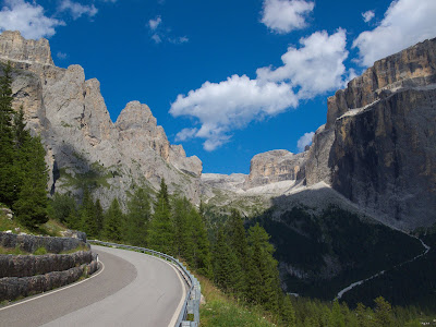
I started early (7am)and with good relatively flat tracks, former railway lines I guess. At about 9am at the detour to Dreilaendereck and since I did not do any research at home I assumed I could cycle to maybe 500m of it. Was a factor 10 off from where I started. Interesting talk to two Austrians, they visit that place and Dreisessel as well, and I missed my turn, next one led me through steep and dense forest for about 250m (well prepared with biking sandals). I met about 200 people on the way up and down and the point was quite crowded. 1pm back at my bike, 2pm on the real road again. Cycled to Klingenbrunn/Spiegelau. Quite a few detours with the luck to take a trail to some swamps on wooden boards. Just 120km at the end of the day.


Dreilaendereck - Plöckenstein - Easternmost Point of Bavaria
The Plöckenstein, known as Plechý in Czech, is a 1,379-meter-high mountain located in the Bohemian Forest on the border between Austria and the Czech Republic. It is the highest peak in the Bohemian Forest for both countries and the highest point in the Mühlviertel and South Bohemia regions. The mountain is famous for being featured in the stories of Adalbert Stifter. Situated between the Austrian municipality of Schwarzenberg to the south and the Czech municipality of Nová Pec to the northeast, the Plöckenstein is home to the Plöckensteiner See, the southernmost of eight glacial lakes in the Bohemian Forest. The northern slope of the mountain is part of the core zone of the Czech Šumava National Park, while the Austrian side is within the Important Bird Area Bohemian Forest and Mühltal, as well as the European protected area Bohemian Forest-Mühltäler, excluding ski facilities. The Jezerní potok (Seebach) stream originates from the mountain, and the Nordwaldkammweg trail passes over it.
The Plöckenstein is located about 1.3 kilometers east of the tripoint where Germany, Austria, and the Czech Republic meet. This area, known as Dreiecksmark or Trojmezí, is a mountain saddle at 1,321 meters that connects the two "Plöckensteins." During the Cold War, the border area of the Bohemian Forest was inaccessible to Eastern European citizens due to the Iron Curtain. However, in December 1989, the new government under Marián Čalfa dismantled the CSSR's border fortifications with the West following the Velvet Revolution. The mid-slopes of the Plöckenstein are covered with acidic spruce-fir-beech forests, while high-altitude spruce forests grow at its highest elevations.

Monday, August 25 2025 - Waldmünchen
Early up and on the bike, small roads west and east of the border and many steep hills. Hot weather all day (the night was 7degrees) and ended up 20km after Furth im Wald and another 400hm climb in Perlsee, Waldmuenchen. Nice neighbour's and a Jever for free. Lots of national and international politics :) cooking now while I write that. Freshly washed clothes were dry in an hour.


The Bavarian Forest – Nature, Mountains, and Borderland Heritage
The Bavarian Forest (Bayerischer Wald) is a low mountain range in southeastern Germany, stretching about 100 km along the border with the Czech Republic and reaching heights of up to 1,456 meters at the Großer Arber. It forms part of the larger Bohemian Massif and is geologically connected to the Bohemian Forest (Šumava) in the Czech Republic. The landscape is characterized by long ridges, dense forests, glacially formed lakes, and granite rock formations created by millions of years of weathering. The area is divided into the Vorderer (Front) and Hinterer (Rear) Bavarian Forest, separated by the geological fault line of the Bayerischer Pfahl. Together with neighboring forests in Austria and the Czech Republic, it forms one of the largest continuous woodland areas in Europe.
In 1970, Germany’s first national park—the Bavarian Forest National Park—was established here and later expanded to 240 km². Together with the adjacent Šumava National Park in the Czech Republic, it protects a vast transboundary wilderness rich in wildlife such as lynx, wolves, bears, and rare bird species. The climate is diverse, ranging from mild lowland valleys to high mountain zones with long snow cover, reflecting both Atlantic and continental influences. Annual precipitation can exceed 1,500 mm in higher areas, while sheltered valleys remain drier. Glacial remnants, including cirques and mountain lakes like Großer Arbersee and Rachelsee, hint at the region’s Ice Age past.
Historically, the Bavarian Forest was part of an ancient, largely impassable border forest, mentioned as Gabreta hyle by Ptolemy. In the Middle Ages, monastic settlements from along the Danube cleared land and developed trade routes, such as the Goldener Steig (Golden Trail), which carried salt from the Alps to Bohemia. Glassmaking became an important regional craft from the Middle Ages onward, flourishing in the 18th and 19th centuries. The modern term “Bavarian Forest” came into use in the early 19th century, largely for administrative and tourist purposes, gradually replacing “Bohemian Forest” for the German side of the range. Political changes since 1989 and the Schengen Agreement have helped reconnect the cross-border region culturally and for tourism.
Tourism plays a central role in the Bavarian Forest economy, with hiking, mountain biking, skiing, and nature education attracting visitors year-round. Zwiesel and other towns are known for traditional glassmaking, while scenic routes and wildlife parks bring nature and local heritage closer to visitors. The “Igelbus” system and an extensive network of trails provide access without harming the ecosystem. Local people refer to the forest affectionately as “da Woid” and themselves as “Waidler,” reflecting a strong regional identity rooted in the forest’s natural and cultural landscape. The Bavarian Forest thus stands as both a haven for biodiversity and a living testimony to centuries of human-nature interaction.


Tuesday, August 26 2025 - Großbüchlberg
From Waldmuenchen a short way across the border, going northwest on small paved and rough unpaved roads for about 70km. Border crossing was a bit adventurous back to Bavaria via a steep trail at the moment just used for wood work. Lunch in Bärnau and via a former rail track to Tirschenreuth and about 15km more to the campsite I keep visiting when I am in the area. Not just nice people but a outdoor swimming pool with strong jacuzzis, and a nice view from that hilltop. And a decent beer from Höslbräu. Did not take much pictures today, the tour was not like some previous, cycling from one highlight to another, but the choice of very small roads sometimes bypassed even small villages completely.


Mitterteich – From Medieval Market Town to Porcelain Heritage
Mitterteich, located in the Upper Palatinate district of Tirschenreuth along Bavaria’s scenic Porcelain Route, has a history dating back to its first mention in 1185. Once under the influence of Waldsassen Abbey, it gained market rights in 1501 and later expanded privileges to hold fairs, sell beer, and trade salt—boosting its economic importance. The Thirty Years’ War brought near destruction, but the community resurged, developing industry with the arrival of railways in the mid-19th century. Glass production began in 1882, followed by the founding of porcelain factories in the late 1800s, turning Mitterteich into a notable hub of fine porcelain manufacturing, a reputation it retained until the closure of its last factory in 2005. Today, part of the former works houses a glass and porcelain museum as well as cultural and community spaces, keeping alive the town’s artisanal legacy.
Granted city status in 1932, Mitterteich offers a blend of historic architecture and active community life. Notable landmarks include the 1731 Town Hall, the neo-Romanesque Catholic Church of St. Jakob (1890), the Protestant Christuskirche (1897), and public monuments such as the Mariensäule and the Schmied von Mitterteich fountain. The town maintains a rich cultural identity not only through its Zoigl beer taverns but also with the Easter tradition of Oierhiartn, a local egg-tapping game. On Easter Sunday afternoon, 50–60 participants, young and old, gather at Johannisplatz to challenge each other by tapping hard-boiled eggs—first tip to tip, then base to base—until one cracks. Victors claim their opponent’s egg, and contests continue until no unbroken eggs remain.

Wednesday, August 27 2025 - Harra - Hurra
The outer rim is hilly. Today another Dreiländereck where I met a former Czech customs officer. Historic place. Via Hof, Naila, and hell and valley of hell (Hölle and Höllental) to a campsite in Harra, well I took the wrong way to approach it via Kießling, quite a steep project. Hurra that I am in Harra now. Go West tomorrow, wind was strong today from the west.


The Historic Dreiländereck – Where Bavaria, Saxony, and Bohemia Meet
The “Dreiländereck” (Three-Country Corner) marks the meeting point of Bavaria (Germany), Saxony (Germany), and Bohemia (Czech Republic). Historically, the borders were defined here in 1843 by a treaty between the Kingdom of Bavaria and the Kingdom of Saxony, with the Austrian Empire to the east. The area around Regnitzlosau, first mentioned in 1234, lies within this triangle and holds a long tradition as a rural settlement with political and cultural ties across all three regions. Today, visitors can explore cross-border hiking routes, including the European long-distance trails E3 (Atlantic – Ardennes – Bohemia) and EV13 (the “Iron Curtain Trail”), as well as regional loops such as the 11.4 km “Dreiländereckweg.” The site is marked by a wooden walkway and boundary stones, symbolizing centuries of shifting political geography.
The Dreiländereck lies within the Franconian Forest Nature Park and is part of the area once divided by the Inner German Border. The signposted circular walks highlight natural, historical, and cultural themes, with viewpoints and opportunities to cross freely between countries—a stark contrast to the decades when the Iron Curtain made this an inaccessible frontier. Today, the trails are marked in both directions and link into local routes in Bavaria, Saxony, and the Czech Republic, making it an attractive destination for hikers, cyclists, and history enthusiasts.
Until 1989, this was a place of strict separation, as the Iron Curtain ran along the border between Eastern and Western Europe. In the shadow of this no-man’s land, an extraordinary strip of nature was able to survive undisturbed for decades. This later became known as the Green Belt—a chain of habitats stretching 12,500 km from the Barents Sea in the north to the Black Sea and the Mediterranean in the south. Today, governmental and non-governmental organizations from 24 countries work together to protect and connect these valuable natural and cultural landscapes. In Germany, the Green Belt runs through all federal states along the former border, preserving both biodiversity and historical memory.
The Bavarian-Saxon-Bohemian section of the Green Belt is about 40 km long and includes diverse habitats important for many rare species. Examples include the endangered Violet Copper butterfly (Lycaena helle) and the Marsh Fritillary (Euphydryas aurinia), as well as protected plants like the Globe flower (Trollius europaeus) and the Stemless thistle (Carlina acaulis). The project also fosters education and sustainable tourism, using the former border strip as an open-air classroom and cross-cultural meeting place. What was once a symbol of division is now a corridor of life, linking landscapes and communities across Europe.


The Selbitz River and the Höllental (Franconian Forest Nature Park)
The Selbitz River has carved deep into the hard diabase rock of the Höllental gorge, creating steep valley walls up to 160 meters high. It originates in Wüstenselbitz at an altitude of 605 m above sea level and flows about 40 km before joining the Saale at Blankenstein (approx. 400 m above sea level), overcoming more than 200 meters in elevation, with 50 meters gained in just a 3.5 km stretch of the Höllental. Its drainage basin covers 213 km². In October 1998, the river’s peak flow was recorded at 80 m³ per second (about the volume of 530 bathtubs every second), while the record in 1947 was 90.5 m³/s. On average, the Selbitz carries 3.16 m³/s and the water quality is rated as Class 2 (“good”). Geologically, the gorge walls consist of ancient diabase, a volcanic rock formed over 370 million years ago when the area was under a prehistoric ocean. Magma that erupted onto the seafloor cooled in contact with water, solidifying into what is now the Franconian diabase. In the Höllental, these rocks form striking hexagonal diabase columns, created by shrinkage cracks during slow cooling. These formations are remnants of a former volcano and contribute to the gorge’s dramatic landscape. In the 19th century, the hard diabase was quarried for use as construction stone, notably during the building of the Höllental railway. Today, remnants of this volcanic history can still be seen in the cliffs and rock piles along the valley.


Thursday, August 28 2025 - Technical difficulties - Ludwigsstadt
On my second day in the Bavarian Forest, I noticed that I had mounted my smallest front chainring the wrong way round, creating a gap large enough for the chain to get caught in. The chain did just that in 50% of cases, but unfortunately I didn't have the right tools with me to fix it. The second problem was the rear brake pads, which still had a lot of material left but were very old, completely dried out, and brittle. The noise was awful, but unfortunately the braking performance was also really poor. Stopover by train from Ludwigsstadt in northern Bavaria to the Ludwigsstadt district of Munich.
Sunday, August 31 2025 - Back on Track
Late start at about 9.30am but made it to a campsite in Wertach. Quiet place, have been there on my 16 summits tour. 150km and no meals, so I was glad for ice cream in Oy and made the last 6km feeling energetic.


Landsberg am Lech - A Historic City on the Romantic Road
Landsberg am Lech is a major district town in Upper Bavaria, located about 55 km west of Munich and 38 km south of Augsburg, along the famed Romantic Road. Known as one of Germany’s sunniest cities, it is perched on the high bank of the River Lech and features a remarkably well-preserved medieval old town. Archaeological finds show the area was settled since the Stone Age, with Bronze Age, Celtic, and Roman remains. The medieval city emerged around the Pfettenburg fortress in the 12th century under Duke Henry the Lion, who rerouted the vital salt trade through Landsberg, fostering its growth. Over centuries, strategic importance, rights to levy salt and river tolls, and thriving trade in salt, grain, and timber shaped the city’s wealth and expansion, leading to impressive fortifications such as the Bayertor, one of southern Germany’s most beautiful city gates.
Landsberg’s history was turbulent: it endured destruction during a succession crisis in 1315 and was rebuilt under Duke Ludwig the Bavarian, who granted it the same rights as Munich. It became a site of religious and political significance, joining the Landsberger Bund in the mid-16th century to defend Catholic interests. The city suffered horrors during the Thirty Years’ War, most notably in 1633 when Swedish and allied troops massacred most inhabitants. The 19th and 20th centuries brought modernization—rail connections, new districts, and industry—yet also a notorious Nazi chapter: Adolf Hitler was imprisoned here in 1924, where he wrote Mein Kampf, and from 1937 Landsberg was propagated as a “City of Youth” for the Hitler Youth. Nearby, the massive Kaufering concentration camp complex exploited forced labor for aircraft production; thousands perished. After WWII, the city became a center for displaced persons, including many Jewish Holocaust survivors, hosting a vibrant DP camp before its closure in 1950.
Today, Landsberg is celebrated for its scenic Altstadt with the triangular Hauptplatz, the baroque Marienbrunnen, the Old Town Hall with its ornate façade by Dominikus Zimmermann, and the baroque Mariä Himmelfahrt parish church. Other highlights include the Schmalzturm, the Jesuit Heilig-Kreuz-Kirche, three preserved defensive walls, the picturesque Lechwehr, and the romantic Mutterturm. Museums and festivals enrich local culture, from the Ruethenfest (every four years) to the Snowdance Independent Film Festival. Music is a strong element of city life, with high-profile organ concerts, choral ensembles, and events like the South German Pottery Market. Sports and recreation also play a role, with ice hockey, football, and a scenic riverside lido among local attractions.
Over time, Landsberg has been home to or associated with well-known figures. Jesuit priest Rupert Mayer, later beatified, recuperated here during WWI and was imprisoned by the Nazis in 1938. Music legend Johnny Cash was stationed in Landsberg as a U.S. Army radio operator from 1951–1954; here he bought his first guitar, formed his band The Landsberg Barbarians, and began writing “Folsom Prison Blues.”


Monday, September 1 2025 - No further south
Via Sonthofen and Oberstdorf into Rappenalptal and as far as my bike would bring me, did not have any hiking boots with me to go all the way and it was a bit wet/slippery. Had a Doener close to Immenstadt and a Turkish cup of tea and since the man was from Antalya we had some common ground and compared doing business in Germany and Turkey. Will spend the night on a farm house area wit some camping attached. Chicken and cats came already visiting.


Haldenwanger Eck – Bavaria's Southernmost Point
The Haldenwanger Eck is a 1,931 m high ridge in the Allgäu Alps, located on the border between Bavaria (Germany) and Vorarlberg (Austria). While the name refers to this area, the actual southernmost point of Germany lies nearby at border stone 147, between Haldenwanger Kopf and Gehrner Berg, at 1,883 m elevation. The point is marked by a granite pillar installed in 1986, replacing the original 1844 border stone, which is now kept at the Bavarian State Office for Surveying. This site also marks the tripoint where Bavaria, Tyrol, and Vorarlberg meet, and it belongs to the municipality of Oberstdorf, about 17 km southwest of the town center.
The Haldenwanger Eck can only be reached via a mountain hike and lies amid higher peaks in the main ridge of the Allgäu Alps, in the headwaters of the Rappenalpenbach (upper course of the Stillach river). Nearby landmarks include Geißhorn (2,366 m), Biberkopf (2,599 m) — often mistakenly called Germany’s southernmost point but actually 110 m further north — and the Trifthütte, Germany’s southernmost building at 1,742 m. The nearest settlement is Einödsbach, 8.3 km to the northeast, the southernmost inhabited place in Germany. Two kilometers north is Birgsau, the second southernmost settlement. Vehicle access is restricted to residents, preserving the remote character of this Alpine borderland.


Generaloberst-Beck-Kaserne in Sonthofen
The Generaloberst-Beck-Kaserne in Sonthofen, Bavaria, was originally built between 1934 and 1942 as the Ordensburg Sonthofen, one of three elite Nazi training schools (alongside Krössinsee and Vogelsang) designed to produce future party and state leaders. Planned by architect Hermann Giesler for the Deutsche Arbeitsfront, the massive complex embodied the monumental style of the era, complete with a 116-meter dining hall and a bell tower with 16 bells symbolically emulating a place of worship. During the Nazi period, the site also served as a main location for Adolf-Hitler-Schulen, hosting up to 1,500 students by 1941, among them actor Hardy Krüger. In its final wartime years, it functioned partly as a military hospital and hosted high-ranking Nazi speeches, including statements by Himmler openly justifying the Holocaust.
After 1945, the building came under French control, before being transferred to the U.S. military in 1947 as the central training facility of the U.S. Constabulary, and later as a U.S. Air Force basic training center. In 1956, it passed to the newly founded Bundeswehr and was renamed in honor of Ludwig Beck, a former Chief of the German Army General Staff and resistance figure against the Nazi regime. Over the following decades, the "Burg," as locals and soldiers call it, hosted several Bundeswehr schools, including the Feldjäger and Staff Service School, the Army NCO School, and the German Armed Forces Sports School. Despite downsizing in the 2010 Bundeswehr reform, the decision was made to keep the site in military use, with the Bundeswehr Fire Protection Center (Zentrum Brandschutz der Bundeswehr) moving in by 2012.
A fundamental renovation and partial expansion began after a 2008 planning competition, with costs estimated at €100 million. Due to the poor condition of the listed historic buildings, work was delayed beyond its initial 2018 completion target, with milestones including the 2016 groundbreaking and the 2019 topping-out of a €22.4 million lecture hall, considered the centerpiece of the redevelopment. Certain unused underground areas are occasionally employed by local emergency services for training exercises. The site, protected as a historic architectural ensemble, thus continues to serve as both an active military facility and a monument to a layered and controversial history — from Nazi indoctrination center to modern Bundeswehr base.

Tuesday, September 2 2025 - Leaving Bavaria
Started a bit south of Kempten and cycled along the Iller via Memmingen and Ulm to Geislingen. 143km but kind of flat until Ulm. 300115km are now shown on my speedometer. In Ulm I left Bavaria and will only be back in 2 days I presume. Well some say that Bavaria has its outposts even in other Bundeslaender...


Der Einlaß – Historic Gate of Memmingen
Der Einlaß is a listed medieval gate complex located on the eastern side of Memmingen’s Ulmer Suburb, near the Bettelturm and adjacent to the Zollergarten. Built of brick in the late Gothic style, the multi-part structure is unplastered, sparsely decorated, and considered one of the most beautiful preserved gates in Germany due to its characteristic Swabian architecture.
Its history dates back to 1475, when a substantial gate replaced an earlier small doorway (Diemerstürlin) that allowed late-arriving pedestrians to enter after the main gate was closed. In front lay the permanently water-filled town moat, crossed only when guards deemed it safe and lowered the drawbridge for a fee. Arrivals then entered a walled forecourt (Zwinger), where they and their carts were searched under the watch of armed city soldiers. Additional fees were charged to open the main gate and conduct customs inspections. Only then could travelers enter the Ulmer Suburb—and even then, they had to wait until morning for the Notzentor to open for access to the city center.
Remarkably, the gate’s small guardhouse remained inhabited until only a few years ago—by an elderly woman—despite lacking electricity and plumbing, preserving a direct human link to centuries of Memmingen’s urban history

Ulmer Tor – Historic North Gate of Memmingen
The Ulmer Tor, also known as the Outer Niedergasse Gate, is one of Memmingen’s historic city gates, located on the north side of the Ulmer Suburb (Ulmer Vorstadt). A section of the old defensive walkway still adjoins the gate, and directly in front stands the Maximilian-Kolbe-Haus. Tall and narrow with a gabled roof, the gate’s design reflects pre–Thirty Years’ War architecture. Modern exterior paintings include a clock and the Imperial Eagle on the north side, while the inner side depicts the 1489 ceremonial entry of King Maximilian I into the city.
The gate’s origins trace back to around 1400, when the Ulmer Suburb was fortified, with the Ulmer Tor serving as its northern exit. The tower was fully completed in 1445. It has witnessed many historic events: Maximilian I’s royal procession (1489), the entry of the Oberschwäbischer Haufen peasant army in 1525 during which the “Twelve Articles” of human rights were written, Wallenstein’s arrival in 1630, the Swedish occupation in 1634, and multiple sieges, including the imperial recapture in 1647. In 1702 it was unsuccessfully defended against Bavarian forces but survived intact. During the city’s last major siege by the French, their withdrawal led to Austrian occupation of the gate.
In 1821, the gate’s function as a military checkpoint ended; the drawbridge and wooden gates were removed. Today, the Ulmer Tor stands as both an architectural landmark and a silent witness to centuries of Memmingen’s political and military history.

Ulm – A City on the Danube with a Towering Landmark
Nestled on the banks of the River Danube in southern Germany, Ulm is a city where medieval charm meets vibrant modern life. Its most famous landmark is the Ulm Minster (Ulmer Münster), boasting the tallest church steeple in the world at 161.53 meters. Climbing its 768 steps rewards visitors with sweeping views over Ulm, the Danube, and even the distant Alps on a clear day. The old town around the minster is laced with cobbled streets, colourful half-timbered houses, and cozy cafés.
Founded around 850 AD and once a Free Imperial City, Ulm has played a significant role in European history as a centre of commerce and culture. Its strategic location on the Danube made it a hub for trade, while its guilds and merchants brought wealth that still shows in its architecture. The Fishermen’s and Tanners’ Quarter (Fischerviertel), with its timber-framed houses and canals, evokes the days when Ulm thrived on fishing, leather-working, and weaving. Ulm is also the birthplace of Albert Einstein, commemorated with a striking monument near the historic centre, symbolising the city’s ongoing connection to science and innovation.

Wednesday, September 3 2025 - LIDL home - Heilbronn
Quite busy roads a day lot of medium sized industries and manufacturers, saw Maerklin today, a supplier for all train aficionados, and AMG tuning and building motor sports cars. And passed by huge white buildings in Heilbronn that had LIDL written on them but no supermarket was there. 116km today, a bit more hilly and passing through the "Tal der Frohen" ("valley of the happy") in Nassach. Had to climb up through that valley.


Märklin
Märklin, founded in 1859 in Göppingen by Theodor Friedrich Wilhelm Märklin, began as a maker of tinplate doll kitchens and domestic toys. After the founder’s death in 1866, his widow and later their sons Eugén and Carl expanded production into tinplate vehicles, ships, carousels, and eventually model trains. In 1891, Märklin acquired Lutz of Ellwangen and began producing standardized track gauges, introducing the famous Gauge 1 train sets in 1892. This standardization shaped the modern model railway industry. Through the early 20th century, Märklin continually expanded its product range, introducing clockwork and later electric trains, and in 1935 debuted scale 00 (now H0) gauge, which would become the global standard.
After World War II — during which Märklin also produced items for the war effort — the company thrived, becoming one of the world’s largest model railway makers in the booming 1950s–60s. It reintroduced Gauge 1 in 1969, launched the ultra-small Z gauge in 1972 (then the smallest in the world), and pioneered digital control systems from the 1980s onward. Alongside high-quality trains, Märklin maintained side product lines such as construction kits, slot cars, and children's toy systems. However, facing changing leisure trends, price pressures, and management issues, the company saw financial trouble in the 2000s. After ownership changes and acquisitions (including Trix, LGB, and Hübner), Märklin filed for insolvency in 2009 amid revelations of high consultancy fees and declining sales.
The business continued under an insolvency administrator until 2013, when it was purchased by Michael Sieber of Simba-Dickie Group. Märklin streamlined its core product range, targeted new audiences, embraced digital upgrades, and strengthened its high-end collector market. Production was consolidated in Göppingen and Győr, Hungary, with some repatriation from Asia. By 2019 Märklin’s sales were climbing again, and during the COVID-19 pandemic in 2020–21 orders surged by 40% as many rediscovered model railroading. The company today dominates the H0 market in German-speaking countries — especially with its proprietary three-rail AC system — and continues developing products across gauges, from H0 to large-scale garden railways.
Märklin enjoys an active collector base, with rare pre-war models fetching high auction prices. Its “Insider Club” and initiatives like the Märklin-Händler-Initiative strengthen customer loyalty and dealer relations. The brand is a cultural touchstone in Germany, featured in specialist literature, TV documentaries, and even luxury limited editions (like the platinum “Millennium Crocodile” locomotive). Beyond selling trains, Märklin markets nostalgia, craftsmanship, and technological innovation. The company’s history is preserved in the Märklineum, a museum and exhibition space opened in 2021 in Göppingen, which chronicles more than 160 years of toy and model train heritage for enthusiasts worldwide.


Heilbronn
Heilbronn, with around 132,000 inhabitants (2024), is the seventh-largest city in Baden-Württemberg. Situated on the River Neckar about 50 km north of Stuttgart, it serves as the main urban centre of the Heilbronn-Franken region and is known for its extensive vineyards – earning it the nickname “City of Wine.” It is also called the “Käthchen City,” after the heroine of Heinrich von Kleist’s play The Käthchen of Heilbronn. First mentioned in 741, the city was granted Free Imperial City status in 1371 and became a key trading hub due to its location on the Neckar and its role in river shipping. Geographically, Heilbronn lies in the fertile Heilbronn Basin, surrounded by orchards and vine-covered hills, with a mild, wine-friendly climate.
From the Middle Ages through the 18th century, Heilbronn was an important centre for trade and craftsmanship. It embraced the Reformation early, experienced economic and cultural prosperity in the 16th century, and suffered during the Thirty Years’ War. In the 19th century, Heilbronn became one of Württemberg’s industrial hubs – dubbed the “Swabian Liverpool” – driven by paper mills, canal development on the Neckar, and railway connections. During World War II, the city was devastated when Allied air raids destroyed most of the old town and killed thousands of residents in December 1944. Reconstruction in the 1950s shaped much of today’s cityscape, later expanded by new districts through municipal reforms.
Heilbronn is a major economic centre with strengths in the metal, chemical, paper, and food industries. Global companies such as Knorr (Unilever), Südwestdeutsche Salzwerke, Kaufland, and Campina originate or operate here. The city is one of the largest wine producers in the Württemberg wine region. Cultural life is rich and varied, with museums, the Heilbronn Theatre, the Harmonie concert and conference centre, festivals like the Heilbronner Weindorf (Wine Village), and Germany’s largest science centre, the Experimenta. Since 2020, Heilbronn has carried the title of “University City,” hosting several institutions on the modern Bildungscampus (Education Campus), and is also home to the new Artificial Intelligence Innovation Park (IPAI).
Today, Heilbronn presents itself as a vibrant, well-connected city. It offers diverse educational facilities, active sports and community life, an integrated public transport network with city and regional rail connections, and the largest inland port on the Neckar, which plays a key role in logistics. Historical landmarks like the Gothic Kilianskirche, the Renaissance Käthchenhaus, and remnants of medieval fortifications stand alongside modern developments such as the award-winning Neckarbogen district. Heilbronn combines its long history and wine-growing tradition with economic strength, cultural diversity, and a high quality of life in the Stuttgart metropolitan region.


Thursday, September 4 2025 - Zwischen Odenwald und Spessart
After busy areas north of Neckarsulm a steady rise in Schefflenztal and long downhill in Odenwald via Buchen to Miltenberg and north along the Main to Aschaffenburg and a bit further to a campsite owned by the local village. Some rain when I set up the tent, but it's clearing up now along that lake.


Odenwald
The Odenwald is a low mountain range reaching up to 626.8 m, spanning parts of southern Hesse, northern Baden-Württemberg, and Lower Franconia in Bavaria. It is bordered in the west by the steep escarpment along the Bergstraße, the Mainz and Neckar rivers marking much of its other edges. The range is divided into the Vorderer (Crystalline) Odenwald in the west, with exposed granites and gneisses due to uplift along the Upper Rhine Rift, and the Buntsandstein (Sandstone) Odenwald in the east, marked by heavily dissected ridges and valleys. Major rivers such as the Weschnitz, Gersprenz, Mümling, and Neckar tributaries drain the region, and the diverse geology has shaped landscapes of rounded ridges, striking rock formations, small lakes, and varied forest ecosystems.
The Odenwald’s foundation lies in the Variscan orogeny 380–320 million years ago, when microcontinents collided to form crystalline basement rocks. Later, during the Triassic and other Mesozoic periods, thick sandstone, limestone, and marl layers were deposited, especially in the eastern half. The Tertiary subsidence of the Upper Rhine Graben uplifted and fractured the range, exposing volcanic rocks such as rhyolite and basalt (e.g., Katzenbuckel volcano). Periglacial processes during the Ice Age shaped block fields and the famous “Felsenmeer” boulder landscapes. The area also holds mineral resources historically mined for ores, sandstone, and marble, though most mining declined before the 20th century due to poor yield and transport difficulties.
Evidence of settlement dates back to the Neolithic, with Bronze and Iron Age burial mounds in many valleys. The Romans occupied the Odenwald from the 1st to 3rd centuries CE, building the Neckar-Odenwald Limes, forts, and rural villas such as the well-preserved Haselburg. After the Roman withdrawal, Alamanni and later Franks populated the area, with monasteries (e.g., Amorbach) spearheading medieval settlement. Over the centuries, various territorial states—from the Electorate of the Palatinate to the Grand Duchy of Hesse—controlled parts of the range. Folklore is rich, with legends of knights, ghosts, devils, dragons, and landmarks tied to epic tales such as the Nibelungenlied, in which Siegfried is slain in the Odenwald.
Today the Odenwald offers castles (e.g., Heidelberg, Breuberg), ruins, and natural attractions like caves, gorges, and panoramic peaks. It is traversed by long-distance hiking routes such as the Nibelungensteig, Burgensteig, Neckarsteig, and Alemannenweg, as well as cycling routes and, in winter, several small ski areas. Towns and villages host festivals tied to wine, history, and local customs, and local dialects vary between Rhine Franconian and South Franconian, reflecting the region’s position between Middle and Upper German language areas. Easily reachable from cities like Heidelberg, Darmstadt, and Aschaffenburg, the Odenwald remains a popular destination for nature tourism, outdoor sports, and exploration of both natural and cultural heritage.


Schloss Johannisburg in Aschaffenburg
Schloss Johannisburg in Aschaffenburg served as the secondary residence of the Archbishops and Electors of Mainz from the 13th century until 1803. The current Renaissance palace, built between 1607 and 1614 by architect Georg Ridinger on the site of a medieval castle, incorporates the old keep as a fifth tower. Constructed from red sandstone, the castle features a perfectly symmetrical four-winged square layout with 52-metre-high corner towers, elaborate Renaissance gables, and a decorative façade. It was surrounded by a dry moat and accessed via a bridge. Inside, the ground floor served administrative and kitchen purposes, the first floor housed the prince-elector’s apartments, and the second floor contained an imperial suite and a grand Kaisersaal.
Later History, Destruction, and Reconstruction In the late 18th century, the castle was renovated in the Neoclassical style under Elector Friedrich Karl Joseph von Erthal. During World War II, it was heavily bombed and burned out in 1945. Reconstruction, guided by historical records, began soon after, though some architectural elements—particularly the tower domes—were altered. Reopened in 1964, the restored building was repurposed for museum use, housing the Schlossmuseum and cultural facilities. Today, it is owned by the State of Bavaria and managed by the Bavarian Administration of Palaces, Gardens and Lakes.
Collections, Gardens, and Cultural Significance Schloss Johannisburg houses the Staatsgalerie Aschaffenburg, featuring Europe’s most important Lucas Cranach collection, works by Rubens and other masters, a Paramentenkammer of ornate liturgical vestments, and the richly decorated St.-Johannis chapel. Other attractions include a world-leading cork model collection of Roman architecture, historic ceramics and furniture, and the state library. The terraced castle gardens along the Main River, with Mediterranean plants, contribute to Aschaffenburg’s nickname “Bavarian Nice.” Hosting regular concerts and cultural events, Schloss Johannisburg remains the city’s architectural landmark and a major tourist attraction.

Pompejanum in Aschaffenburg
The Pompejanum in Aschaffenburg is a 19th-century reconstruction of a Roman villa, modeled on Pompeii’s Casa dei Dioscuri. Commissioned by King Ludwig I of Bavaria and built between 1840 and 1848 to plans by Friedrich von Gärtner, it was intended not as a royal residence but as an educational monument for the study of ancient culture in Germany. Adaptations to its riverside location included a second-story belvedere, an external columned staircase, and a glazed atrium. The ground floor, centered on an open atrium and a garden courtyard (viridarium), contains reception rooms, guest rooms, dining spaces, and service areas, while the upper floor holds private chambers. Painted in Tuscan style with a Pompeii-red base and ochre-yellow façade, the villa’s richly decorated interiors and mosaic floors replicate ancient Roman models, executed by artists such as Christoph Friedrich Nilson and Joseph Schlotthauer.
Severely damaged in World War II and robbed of artworks in its aftermath, the Pompejanum was gradually restored from 1960 onward. Since 1994, it has displayed original Roman artworks from Munich’s State Collections, including marble sculptures, bronzes, glassware, and rare marble deity thrones. Exhibits also portray the daily life of a Roman family, and since 2014 include a Roman military diploma from 78 CE. Managed as a branch museum by Munich’s State Antiquities Collections and Glyptothek, the villa sits above Aschaffenburg’s oldest vineyard. This small Riesling plot produces a tiny yield, with the wine, known as “Pompejaner,” reserved for official city receptions and special occasions.
Friday, September 5 2025 - Zwischen Spessart und Rhön
Some rain and small roads via Bad Orb to Wildflecken. Early in the morning at Cabo Fisterra of Bavaria, the westernmost point. Tomorrow a bit behind Fladungen the North Cape of Bavaria. Up to Wildflecken I took the Rhönexpress cycle trail.


Spessart
The Spessart is a low mountain range spanning parts of Bavaria and Hesse, lying between the Vogelsberg, Rhön, and Odenwald. It contains Germany’s largest continuous mixed deciduous forest and is bordered by the Main, Kinzig, and Sinn rivers. Its rolling wooded hills reach a maximum height of 586 m at the Geiersberg, with valleys leading to small settlements and farmland. Geologically, the Spessart consists largely of Buntsandstein (red sandstone) overlaying older crystalline basement rocks, with localized deposits of limestone, diorite, gneiss, and former mining areas for ores and minerals. The region is divided into the western Vorspessart and the larger Sandstone Spessart and includes two nature parks: the Bavarian Spessart (1,710 km²) and the Hessian Spessart (740 km²).
Historically a royal forest under the Merovingians, the Spessart served as a hunting ground for German kings and later came under the rule of the Archbishopric of Mainz, the Bishopric of Würzburg, and other small territories. Political fragmentation encouraged banditry, made famous by Wilhelm Hauff’s 1827 tale Das Wirtshaus im Spessart. In the 18th and 19th centuries, the region’s economy drew on forestry, glassmaking, ironworking, and small-scale mining, though agriculture was poor. Industrialisation and better transport weakened traditional trades, leading to poverty and widespread poaching, which persisted into the 20th century. Today, some historic industries remain, such as glass production in Lohr, alongside modern enterprises like Bosch Rexroth.
The Spessart is rich in cultural heritage, from medieval castles and monasteries to rural folk architecture. Notable sites include the water castle Schloss Mespelbrunn, the pilgrimage church in Hessenthal, and the Carolingian church in Neustadt am Main. Museums in Lohr, Wertheim, and Aschaffenburg showcase the region’s history, glassmaking, and geology. Its folklore—centred on forests, poverty, and “Spessart robbers”—remains a strong cultural identity, reinforced by literature, films, and preserved legends. Abandoned mining sites, lookout towers, and well-marked hiking trails such as the ancient Eselsweg and Birkenhainer Straße attract visitors, as do wine routes along the Main.
Large parts of the Spessart are protected as nature parks, landscape conservation areas, and numerous nature reserves, safeguarding habitats for diverse flora and fauna. Past proposals for a Spessart National Park in the Bavarian High Spessart met strong local resistance due to traditional wood-use rights and forestry interests. Today, tourism plays a vital role, promoted via outdoor recreation, cultural routes, wellness facilities like the Bad Orb salt works, and picturesque Fachwerk towns such as Gemünden, Lohr, Wertheim, and Miltenberg. The area is accessible via the A3 motorway, major federal roads, and regional railways, serving as both a local recreation area and a destination of national significance.


Strecke 46 – The Forgotten Autobahn
Strecke 46, a planned but never completed motorway (autobahn) between Bad Hersfeld and Würzburg in Germany, intended as part of the long north–south route from Hamburg to Italy. Construction began in the late 1930s during the Nazi era, but the project was halted by World War II and never resumed. Today, parts of the route survive as abandoned earthworks, bridges, tunnels, and embankments, slowly being reclaimed by nature.
Station were built to bring in workers and materials for the construction of Strecke 46. Sand, gravel, cement, and machinery were delivered; temporary sidings were installed. Concrete elements for bridge construction were cast on site and transported by light railway. The station became a hub for the workforce until work stopped in October 1939, when most employees were dismissed. Construction elements left behind, like the station building, are still standing as relics. Visitors are warned not to climb on or enter the structures due to safety hazards.
Strecke 46 was to run roughly 70 km, with 3 traffic junctions, 6 rest areas, and serious engineering works: 2 tunnels, 17 large bridges, and numerous underpasses. Work began in 1937, including massive excavations and embankments. Much of the earthworks were completed, but with the outbreak of war in 1939, priorities shifted, resources were taken away, and construction stopped altogether in 1942. The unfinished road survived as the largest abandoned autobahn building site in Germany.
Planned as part of Adolf Hitler’s grand autobahn vision, Strecke 46 symbolised Nazi infrastructure ambition. However, after years of abandonment, unmaintained structures fell into decay. Many bridges and embankments are now overgrown, though some remain impressive. For locals, this “forgotten autobahn” is a monument to history, failure, and changing priorities.
Saturday, September 6 2025 - North Cape
Reached Bavarias North Cape via Fladungen this morning and cycled on to Mellrichstadt for train back to Munich with just one change in Wuerzburg.