Biking and Hiking New Zealand - 09 Nelson, Golden Bay
Rain again the next morning, unfortunately, but sunshine later in the afternoon in Nelson and Richmond. In Motueka I booked a campsite in Abel Tasman National Park and a water taxi back to Mārahau. It didn't take much guessing that the girl who arranged that for me was from Austria — she had already lived in New Zealand for six years — and I was able to pinpoint her to Tyrol (bischd a Tiroler, bischd a Mensch...), to the other ones, Pākehā from NZ or tourists, the conversation that followed was in te reo...


Nelson
Nelson, known in Māori as Whakatū, is a city and unitary authority located on the eastern shores of Tasman Bay at the top of New Zealand's South Island. Established in 1841 and becoming a city by royal charter in 1858, it holds the distinction of being the oldest city in the South Island and the second-oldest in the country. Nelson is unique as the only consolidated city-region in New Zealand.
The city is bordered by the Tasman District to the west and south-west and the Marlborough District to the north-east, east, and south-east. With a population of 51,300, Nelson ranks as New Zealand's 15th most populous urban area. It is renowned for its vibrant arts and crafts scene, hosting events like the Nelson Arts Festival that attract both locals and tourists.
Nelson was named in honor of Admiral Horatio Nelson, who triumphed at the Battle of Trafalgar in 1805. Many streets and public spaces in the city bear names related to this historic battle. The Māori name Whakatū means 'construct', 'raise', or 'establish'. Nelson is often referred to as "Sunny Nelson" due to its high sunshine hours or "Top of the South" for its geographic location.
The settlement of Nelson began around 700 years ago by Māori, with early iwi including Ngāti Hāwea, Ngāti Wairangi, Waitaha, and Kāti Māmoe. The area saw significant changes in the early 1600s with the arrival of Ngāti Tūmatakōkiri, and later in the 1820s, when raids by northern tribes led by Te Rauparaha displaced the local population. Today, eight tribes are recognized in the region.
Nelson is home to several historic sites, including Broadgreen Historic House, Isel House, and Founders Heritage Park. Broadgreen Historic House, built in 1855, now serves as a museum. Isel House, once home to the Marsden family, features public displays and is managed by a charitable trust. Founders Heritage Park offers an interactive experience of Nelson's history, set up as a historical village.
Nelson's rich history and cultural heritage are complemented by its natural beauty and outdoor attractions. The city is a gateway to the Abel Tasman National Park, known for its stunning coastal scenery and hiking trails. Nelson's climate, with its high sunshine hours, makes it an ideal location for vineyards and orchards, contributing to its reputation as a center for fine wines and fresh produce.

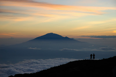
Quite a few Germans settled in the nearby area of Upper Moutere in the 1840s. With more bad weather ahead, I decided to ride to Farewell Spit via the 800-metre Takaka Hill — another dead end, unfortunately. Nearby are Te Waikoropupū Springs, where about 11,000 litres of reputedly some of the clearest water in the world surge up every second. The average age of that water is said to be around ten years.

Upper Moutere
Upper Moutere, originally named Sarau by its German settlers, is located in the Tasman District near Motueka at the top of New Zealand's South Island. The New Zealand Company sought German emigrants as early as 1839, appointing an agent in Bremen. Although plans to sell the Chatham Islands to a German colonization society were thwarted, German settlers were granted British subject status upon arrival in Nelson.
In 1843, 140 German immigrants, mostly Lutheran Protestants with some Bavarian Catholics, arrived on the ship St Pauli, forming the villages of Sarau (now Upper Moutere) and Neudorf. The journey took 176 days, during which four children died, seven couples married, one baby was born, and two passengers deserted at a harbor stop.
The initial prosperity of the settlements was short-lived due to land and capital shortages, leading to a period of depression. Immigration halted until the 1850s, and wages for laborers were reduced. By 1846, a quarter of the immigrants had left Nelson.
Charles Kelling led the second wave of German immigrants on the ship Skjold in 1844. After founding the village of Ranzau with his brother, he moved to Sarau and became a community leader. Kelling served on the Nelson Provincial Council, representing the Moutere and Waimea West electorates.
The village of Sarau was renamed Upper Moutere during World War I due to anti-German sentiment.


Te Waikoropupū Springs
Te Waikoropupū Springs, also known as Pupu Springs and Waikaremumu Springs, are located in Golden Bay, within New Zealand's Tasman District on the South Island. Renowned for their exceptionally clear water and significant discharge volume, these springs hold spiritual importance for the Māori people. They feed into the Te Waikoropupū River, a tributary of the Tākaka River.
Water Clarity: The springs boast the clearest water ever recorded from a karst spring, with horizontal visibility averaging 63 meters. Until 2011, they were considered second only to sub-glacial waters in Antarctica for clarity. However, Blue Lake in the Tasman District now holds the record for freshwater clarity.
Aquifer: The springs originate from an aquifer beneath the Tākaka Valley, covering a catchment area of 940 km² and rising to 1,650 meters. The aquifer comprises the Takaka Unconfined Gravel Aquifer, Takaka Limestone Aquifer, and Arthur Marble Aquifer, with the latter being the primary source for the springs.
Volume of Water: The springs discharge a notable volume of water from eight main vents, with a mean outflow of 13.4 m³/s. The lake floor is covered with white sand, and some smaller vents create 'dancing sands' by carrying the sand upward, a highlight for scuba divers who have permission to explore the springs.
Spiritual Significance: The springs are sacred to the local iwi and registered as wāhi tapu with the Māori Heritage Council. They are considered the legendary home of the taniwha Huriawa, a guardian spirit believed to reside in the waters. The springs symbolize the connection between earth and sky, representing the lifeblood of Papatūānuku and the tears of Ranginui.
Cultural Importance: Signboards at the springs' entrance highlight their significance as a taonga (treasure) and a place of ceremonial blessings. The Department of Conservation notes that the springs are a source of waiora, the purest form of water, providing healing and spiritual sustenance.
Conservation Efforts: Efforts to protect the springs emphasize their ecological and cultural value. The local iwi and conservation authorities work together to preserve the springs' pristine condition and ensure their continued significance for future generations.


At breakfast I met Inga and Günter from Munich-Westpark, and I went with them in their rental car to Farewell Spit and Collingwood. Cycling there in wind and rain would not have been much fun that day, so this turned out to be a very good alternative.


Golden Bay
Golden Bay / Mohua is a large, shallow bay located in New Zealand's Tasman District at the northern tip of the South Island. It is part of the Tasman Sea and lies northwest of Tasman Bay and Cook Strait. The bay is protected by Farewell Spit, a 26 km long sandspit, and is fed by the Aorere and Tākaka rivers.
Historically, the bay served as a resting area for migrating whales and dolphins, including southern right whales and humpback whales. Pygmy blue whales can also be observed off the bay. The western and northern regions are largely unpopulated, while the southern coast hosts the towns of Tākaka and Collingwood, as well as Abel Tasman National Park and parts of Kahurangi National Park.
Golden Bay is a popular tourist destination known for its good weather and relaxed lifestyle. Beaches like Tata Beach attract retirees and holidaymakers, with many owning holiday homes, known locally as baches.
The bay has undergone several name changes over the years. Māori originally named it Mohua after a native bird. Abel Tasman named it Moordenaarsbaai in 1642 after a violent encounter with local Māori. It was later called Massacre Bay, Coal Bay, and finally Golden Bay following the discovery of gold in the late 1850s. In 2014, it was officially given the dual name Golden Bay / Mohua.
Māori have lived along the shores of Golden Bay since at least 1450. The area was initially inhabited by Waitaha, Ngāi Tara, and Ngāti Wairangi, who were displaced by Ngāti Tūmatakōkiri in the early 1600s. Abel Tasman's arrival in 1642 led to a violent encounter with the Māori, resulting in the bay's initial name, Moordenaarsbaai.
European settlement began in 1842 with the Lovell family at Motupipi. The discovery of coal and gold in the area led to increased European interest and settlement. The road over Tākaka Hill, completed in 1888, improved access to the bay, which was previously reached mainly by sea.
Coal mining began in Pūponga in 1895, with significant production until 1974 when it became uneconomic. The Onekaka Ironworks, established in 1924, was powered by a hydroelectric scheme but closed in 1935 due to economic challenges. It was nationalized but never successfully revitalized, closing permanently in 1954.


Colingwood Tame Eels
We are long finned eels. NZ largest native fish. We live up to 100 years. We can live out of water. We breed only once and then die. Eeels go to breed 25-100 years. We breed in Tongan Trench. Baby eels swim back to NZ. Large eels like us are female. We are about 50 years old. We are not covered in slime. Slime is only used in defence.


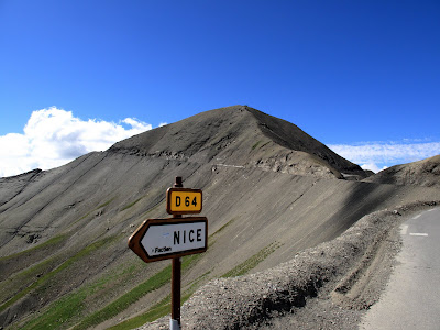
Back from Golden Bay to Motueka, you first have to climb Takaka Hill again — about 800 metres — and then, to start the track from Mārahau, another smaller hill of about 250 metres has to be crossed. Old MacDonald’s Farm in Mārahau turned out to be a good place to store my bike in a shed at the campsite.


Bicycle Wisdom
"U can't buy happiness but u can buy a bike and that's pretty close."
"When the spirits are low, when the day appears dark, when work becomes monotonous, when hope hardly seems worth having, just mount a bicycle and go out for a spin down the road, without thought on anything but the ride you are taking."
- Arthur Conan Doyle
"It thought of that while riding my bicycle."
- Albert Einstein
"Life is like a 10-speed bicycle. Most of us have gears they never use"
- Charles Schultz


Motueka
Motueka is a town located on the South Island of New Zealand, near the mouth of the Motueka River on the western shore of Tasman Bay. It is the second-largest town in the Tasman Region, with a population of 8,300 as of June 2024. The area is known for its apple, pear, and kiwifruit orchards, as well as specialized crops like hops. Historically, it was the center of tobacco growing in New Zealand until the early 1980s.
The region is popular with holidaymakers, featuring nearby beaches such as Kaiteriteri and Mārahau. Motueka enjoys one of the highest annual sunshine-hour indices in the country. It is also a base for tourism ventures to Abel Tasman and Kahurangi National Parks, as well as Nelson Lakes National Park. The area attracts outdoor enthusiasts with its limestone cave systems, sea kayaking, tramping, and canyoning opportunities.
Motueka has a vibrant arts scene, with many local artists, potters, and reggae musicians. The nearby Riverside Community in Lower Moutere is New Zealand's oldest cooperative living community, founded in the 1940s as a pacifist intentional community.
The name Motueka comes from the Māori language, meaning "weka island," referring to a bird of the rail family. The town is colloquially known as "Mot" by some residents.
The first known European visitor to the area was French explorer Jules Dumont d'Urville in 1827. The New Zealand Company's Nelson expedition, led by Captain Arthur Wakefield, arrived in 1841. Motueka was establ
ished as a town in 1842 due to its fertile soil and suitable land for small farms.Motueka was administered as part of the Nelson Province from 1853 to 1876. It became a borough in 1900, with the first borough council meeting held on 17 January 1900. The post office building was opened in 1902 by Sir Joseph Ward.
The Motueka war memorial, unveiled in 1922, commemorates the 32 soldiers from the district who died in World War I. A plaque added in 1957 honors the 35 soldiers who died in World War II.