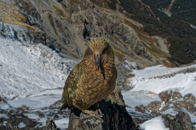
Biking and Hiking New Zealand - 10 Abel Tasman Track
About four hours on a very good and pleasant coastal track to Torrent Bay, which can only be crossed within about two hours of low tide. Another three hours brought me to Bark Bay, where there is space for around 40 tents and a wonderful sandy beach for a swim. If you start early — around six o’clock — you have the track almost to yourself for a few hours. I walked part of the way with Sina, who continued on to a hut in the evening. At my campsite I met Sarah from Germany, who had spent three years in South America and was now spending a year in New Zealand. We talked until the sun went down.
It is a bit of a nuisance that you have to carry your tent, sleeping bag, mattress, stove, food, and everything else for just one night in your tent. Still, with good weather, these were two of the best days I have ever had on a walk. You meet quite a few people — you never walk alone.


Abel Tasman National Park
Abel Tasman National Park is New Zealand's smallest national park, covering 237.1 km² at the northern end of the South Island, between Golden Bay and Tasman Bay. Despite its size, it is one of the most visited parks, largely due to the popular 60 km Abel Tasman Coast Track.
The park's area has a history of human interaction spanning approximately 700 years, with early Māori iwi such as Waitaha and Rapuwai inhabiting the region. European arrival in the 19th century led to deforestation, farming, and quarrying, significantly altering the landscape. Today, park management focuses on ecosystem regeneration and restoration.
Established in 1942 to commemorate the 300th anniversary of Abel Tasman's visit, the park has expanded over the years. The most recent addition was 7 hectares in Awaroa Inlet, acquired through a crowdfunding campaign.
Historically, the coastal area was inhabited by Māori who utilized local resources for food and agriculture. The area saw various iwi, including Muaūpoko and Ngāti Tūmatakōkiri, before European exploration by Abel Tasman in 1642.
The park's establishment was driven by ornithologist Pérrine Moncrieff, who advocated for land reservation. It was officially opened in December 1942, with the Netherlands' Queen Wilhelmina as its patron.
The park initially comprised 15,225 hectares, with land donated by the Golden Bay Cement Company for the Abel Tasman Monument. It has since grown through additional land purchases, including significant expansions in 1946 and 2008.
Geographically, the park features forested, hilly terrain north of the Tākaka and Riwaka Rivers, bordered by Golden Bay and Tasman Bay. It includes several islands, such as the Tata Islands and Tonga Island.
The park's coastal areas are designated as a Scenic Reserve, and the adjacent Tonga Island Marine Reserve protects marine life. The Abel Tasman Monument, located near the park's northern end, commemorates the first European-Māori contact.


New Zealand Great Walks
The New Zealand Great Walks are a collection of premier tramping tracks maintained by the Department of Conservation, showcasing some of the country's most stunning landscapes, from coastal beaches to alpine terrains. These tracks range from 32 km to 82 km in length, typically taking 3 to 6 days to complete, with the Whanganui Journey being a 145 km river journey over 5 days. Only the Tongariro Northern Circuit and the Kepler Track are loop walks; others require transport back to the starting point.
Established in 1992, the Great Walks network was created to promote hiking and manage the impact of tourism on popular tracks. The Great Walks feature well-equipped backcountry huts and tracks maintained to a high standard, attracting many international visitors. Booking systems are in place to manage visitor numbers, and guided walks are offered by private operators. While walking access is free, charges apply for overnight stays at huts or campsites. Camping is restricted to designated areas to protect the environment.
North Island Great Walks include the Lake Waikaremoana Great Walk, Tongariro Northern Circuit, and Whanganui Journey, a canoe voyage on New Zealand's longest navigable river.
South Island Great Walks feature the Abel Tasman Coast Track, Heaphy Track, Routeburn Track, Milford Track, Paparoa Track, Kepler Track, and Hump Ridge Track. The Abel Tasman Coast Track is the most popular, while the Milford Track is the most famous.
On Stewart Island / Rakiura, the Rakiura Track offers a unique experience in a remote and rugged environment.


Up and down through forest, jungle-like sections, and long sandy beaches, until you reach Awaroa Inlet, where once again you have to wait for low tide. Sina, Sarah, and I then walked another two hours to Tōtaranui, where you can catch a water taxi — really just a small boat for about ten people — back to Mārahau. Back at Old MacDonald’s Farm, I met Elli, a Tyrolean ski instructor who finally spoke a proper dialect.


Abel Tasman Coast Track
SAFETY - Tidal crossings
There is one area on the track that is only passable near low tide: Awaroa Inlet can only be crossed within 1 hr 30 min before and 2 hr after low tide. It is dangerous to cross outside of these times The estuaries of Torrent Bay and Bark Bay can be crossed near low tide but also have all-tide tracks around them. At Goat Bay and Anapai, the track follows the top of the beach. Anapai is passable at all times. At Goat Bay a short section of the beach may be impassable during spring high tides.
The Abel Tasman Coast Track is a 60 km walking trail in New Zealand's Abel Tasman National Park, stretching from Mārahau in the south to Wainui in the north. Known for its mild weather and scenic views, the track is accessible year-round and is one of the country's Great Walks. It offers a mix of independent and guided walking options, with opportunities for sea kayaking along the protected coastline.
The track can be completed in 3 to 5 days, with single-day walks also popular due to boat access at various points. The only road access, aside from the start and end points, is at Tōtaranui. Water taxis provide transport between Mārahau and Tōtaranui, making sections like Bark Bay to Torrent Bay, with its swing bridge and stunning views, popular for shorter walks.
Overnight stays require reservations at designated DOC campsites and huts, with some commercial lodges available. The track includes tidal crossings, so walkers must plan around low tides.
The track is divided into sections with huts at Anchorage Bay, Bark Bay, Awaroa Inlet, and Whariwharangi Bay. Mārahau, the starting point, offers amenities like a DOC information center and accommodation. The first section to Anchorage Bay features several small bays and a side track to Cleopatra's Pool.
From Anchorage Bay to Bark Bay, the track crosses the Torrent Bay estuary, which can be navigated at low tide or bypassed via a high tide track. The Bark Bay to Awaroa Inlet section passes through the Tonga Island Marine Reserve and includes a tidal crossing at Awaroa Bay.
The track from Awaroa Inlet to Whariwharangi Bay is 16.9 km long, with campsites along the way. It includes a tidal crossing at Awaroa Inlet and scenic views from Skinner Point. Tōtaranui offers the only road access and a camping ground.
North of Tōtaranui, the track is less frequented but equally scenic, featuring beaches like Anapai Bay and Mutton Cove. A side track to Separation Point offers views of a seal colony and a lighthouse.
The final section from Whariwharangi Bay to Wainui Bay is a 5.7 km walk over a saddle to the estuary's edge. Mountain biking is not allowed on the track, but is permitted on the Gibbs Hill track from Tōtaranui to Wainui Bay during certain months.