Biking and Hiking New Zealand - 14 Akaroa to Lake Tekapo
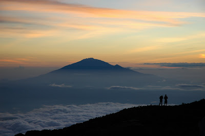
The weather was very hot, and a woman in a café in Christchurch simply said, referring to the conditions: “Go to the beach.” And yes, I cursed more than one hill that day on the partly unpaved roads toward Pigeon Bay. The campsite was about 75 metres above the town. Today: 105 km. The Banks Peninsula can be quite demanding on a hot day if you choose to maximise the ups and downs via Summit Road, Diamond Harbour, Port Levy, Pigeon Bay, and the outer Summit Road to the old French settlement of Akaroa.


Akaroa
Akaroa is a charming harbour town on the Banks Peninsula in New Zealand’s South Island, famous for its French heritage, picturesque setting, and dolphin encounters. The name means “Long Harbour” in Kāi Tahu Māori, and the area was shaped by the remnants of a Miocene volcano. Just 84 kilometres from Christchurch, Akaroa's scenic hills and sheltered waters once attracted whalers, and today they draw visitors seeking a peaceful escape. Its unique historical blend stems from both Māori traditions and European ambitions—particularly the rare French attempt at colonisation in New Zealand.
In 1838, French whaler Jean François Langlois claimed to have purchased much of Banks Peninsula from twelve Māori chiefs, planning a settlement supported by the Nanto-Bordelaise Company. In August 1840, 57 settlers—mainly French and German—arrived to find HMS Britomart and the Union Jack already in place, as Britain had proclaimed sovereignty over all of New Zealand just weeks earlier. Despite initial disputes over land ownership, Akaroa developed as a hybrid community, with French street names, a French mayor, doctors, and courts, alongside British settlers who soon claimed their share of the port and farmland. Today, traces of this heritage remain strong in the architecture and culture.
Akaroa evolved into a thriving holiday haven by the late 19th and early 20th centuries, its waterfront lined with general stores, wharves, and fishing vessels. The historic Daly’s Wharf, built in the 1860s, still welcomes boats, while the restored Akaroa Lighthouse—moved from its rugged original site in 1980—offers a glimpse into maritime history. Churches such as Saint Peter’s Anglican and Trinity Presbyterian, along with the Akaroa Museum’s colonial artefacts, preserve the layered past of Māori, French, and British settlement. Beyond the heritage, Akaroa is famed for the Hector’s dolphins of its marine reserve, with boat tours allowing visitors to swim alongside these rare creatures.
Modern Akaroa, with around 780 residents, retains a relaxed pace but remains a popular cruise ship stop—especially after the 2011 earthquakes closed nearby Lyttelton port. Visitors stroll its boutique-lined waterfront, explore volcanic landscapes like Ōnawe Peninsula, and enjoy local cuisine often reflecting its French roots. Whether for its rich history, coastal beauty, or wildlife encounters, Akaroa stands as one of New Zealand’s most distinctive towns—a place where a French flag once flew, but where diverse influences now blend into a uniquely Kiwi charm.


Akaroa, “Schicksalsberge,” and my own foolish planning from the desk at home: I ended up climbing 2 × 750 metres via Bossu Road, which made for quite a detour. From midday onward the route became flatter along a small river, but there was a headwind. In the evening, shortly before Rakaia, the wind turned southerly and light rain set in — what fun.


Rakaia
Rakaia is a small Canterbury town on the South Island of New Zealand, set along the southern banks of the wide, braided Rakaia River. Just 57 km south of Christchurch on State Highway 1, it is famous for its enormous fibreglass salmon sculpture, a nod to the river’s reputation for salmon fishing and jetboating. The town sits beside New Zealand’s longest road and rail bridges, each stretching about 1,750 metres across the river’s shingle beds. Once a railway junction for the Methven Branch line (1880–1976), Rakaia has a history marked by rural industry and community resilience—though also by tragedy, as in the 1899 railway station accident that claimed four lives.
Despite its modest size, Rakaia boasts notable heritage landmarks. Saint Mark’s Anglican Church, designed in 1877 by architect Benjamin Mountfort, showcases classic wooden Gothic design, while the century-old Rakaia Post Office and the long-standing South Rakaia Hotel reflect its early 20th-century growth. The town, originally known as Cholmondeley before adopting its Māori name, has steadily expanded, with a population of around 1,670 today. Visitors are drawn not only to its fishing and river scenery but also to explore its historic buildings and enjoy the relaxed, welcoming atmosphere of this gateway to the Canterbury Plains.

Only about two months left on the trip. On the way inland from Rakaia the weather improved nicely. First coffee break in Mayfield. Between Geraldine and Fairlie my legs started to feel heavy and tired. In the evening I shopped for the coming days around Mount Cook. Hopefully the weather would stay good — I wanted clear visibility in the mountains. The Canterbury Plains between Rakaia and Geraldine were a bit boring: New Zealand’s longest bridge, a giant salmon statue, plenty of sheep, and not many hills. Pretty flat, really.


Geraldine
Geraldine, known in Māori as Heratini, is a picturesque town in Canterbury, South Island, situated on State Highway 79 between the Orari and Hae Hae Te Moana Rivers. About 140 kilometres south of Christchurch and inland from Timaru, Geraldine has deep historical roots, with evidence of Māori travel routes and settlements in nearby valleys. The area became part of the Canterbury Purchase in 1848, and by the mid-19th century early European settlers had established timber milling and sheep runs as the main industries. Originally called Talbot Forest, then Fitzgerald, the town was eventually named Geraldine—though the origin of the name remains uncertain. Today, native forest remnants such as Talbot Forest Scenic Reserve, with 800-year-old tōtara trees, surround the town, and wildlife like New Zealand’s endangered long-tailed bats adds to its ecological significance.
Geraldine blends rural charm with vibrant tourism and heritage. It’s home to Barker’s of Geraldine, well-known for producing jams and chutneys, and acts as a gateway for travellers heading to the Mackenzie Country and alpine attractions like Wānaka and Queenstown. Visitors can enjoy boutique shopping, cafes, museums—such as the Geraldine Vintage Car & Machinery Museum—and numerous heritage-listed buildings, including the Crown Hotel and St Mary’s Anglican Church. Outdoor activities range from rafting and horse trekking to golf, while community facilities like the Geraldine Domain, summer pool, and local cinema give the town a welcoming, small-town feel. With its combination of history, lush surrounds, and warm hospitality, Geraldine remains a treasured stop on any South Canterbury itinerary.


Fairlie
Fairlie is a small but significant township in Canterbury’s Mackenzie District, known as the “gateway to the Mackenzie Basin.” Situated on State Highway 8 between Christchurch and Queenstown, it serves travellers heading to Tekapo, Mount Cook and beyond. Originally called Fairlie’s Creek after a nearby stream, its name was inspired by a town in Scotland. The surrounding landscape features the Ōpihi River and rolling rural scenery, with the town enjoying warm summers and frosty winters. Historically, Fairlie was served by the Fairlie Branch railway from 1884 to 1968, and today it functions as a service centre, with tourism becoming increasingly important. A statue of legendary shepherd James Mackenzie and his dog stands prominently in town, reflecting local heritage.
Despite its modest population of around 960, Fairlie has a lively community and a surprising array of attractions. Outdoor activities abound with nearby ski fields at Mount Dobson and Fox Peak, an 18-hole golf course, an ice rink dating back to the 1930s, and annual events like the Mackenzie Agricultural and Pastoral Show. Visitors often stop for the famous Fairlie Bakehouse pies before exploring the Fairlie Heritage Museum’s impressive collection of vintage wagons and carriages. The town also offers swimming facilities, a skate park, and rugby grounds, giving it a rich sporting culture. With its heritage buildings, friendly atmosphere, and strategic location for travellers, Fairlie is both a charming stopover and a gateway to some of New Zealand’s most stunning high-country landscapes.

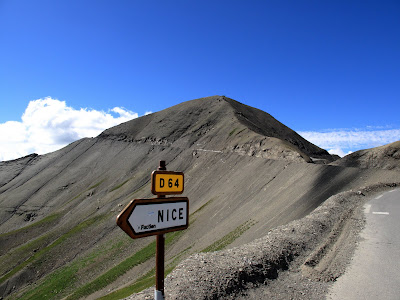
The hills, and then the real mountains, begin after Geraldine. There were some spectacular views from near Mount Michael and Burkes Pass, with multi-coloured lupins along the roadside. Lakes Tekapo and Pukaki have that remarkable turquoise-blue colour caused by fine rock flour suspended in the water. There is an observatory on Mount John, only about a 45-minute walk above Lake Tekapo, and the Astro Café serves very decent coffee and cake.


Three Creeks in Burkes Pass
Three Creeks in Burkes Pass is one of those roadside stops that instantly transports visitors into a different era. Set among the rolling Mackenzie Country hills on State Highway 8 — the scenic route between Christchurch and Queenstown — it’s housed in a cluster of character-filled buildings including a 1950s-style service station, an old general store, a blacksmith’s workshop, and a trading post. Each space is crammed with artworks, locally crafted wooden furniture, retro memorabilia, tin signs, and eye-catching giftware. A retro coffee caravan serves hot drinks for travellers, inviting them to linger and explore the nostalgic surroundings.
Part of Three Creeks’ charm is the outdoor display, which features an eclectic mix of classic cars, motorbikes, tractors, and vintage farm machinery. The vehicles are not just parked there; they’re integrated into the experience, creating a kind of open-air museum where gleaming chrome sits alongside weathered steel. Visitors will often photograph the pastel-coloured American Fords and Chevrolets, the rugged old utes, or distinctive New Zealand classics that make up this colourful line-up. The arrangement changes from time to time, so repeat visitors may find new gems among the collection.
This quirky destination has cemented itself as a popular stop in the Mackenzie Region. Burkes Pass holds its own rural charm, with Three Creeks providing the main draw thanks to its distinctive retro styling and mix of antiques and collectibles. Lonely Planet even singled it out as a “must-see,” reflecting its growing reputation among both domestic and international tourists who enjoy roadside Americana in a Kiwi high country setting.
More than just a shop, Three Creeks blends retail, history, and outdoor exhibits into a relaxed space where travellers can soak in Mackenzie culture. Whether you’re browsing hand-crafted wood tables, checking out petrol pumps from mid-century New Zealand, or sipping a coffee surrounded by vintage Fords and Holdens, the experience is part nostalgic time travel, part celebration of rural ingenuity. For many, the classic car display is the highlight — a visual nod to past decades that fits perfectly with the rugged, timeless landscape of the Mackenzie Basin.


Lake Tekapo
Lake Tekapo (Takapō in Māori) is the second-largest of three strikingly turquoise glacial lakes lying along the northern edge of New Zealand’s Mackenzie Basin. Its name in Māori means “to leave in haste at night,” and local Ngāi Tahu legends tell of its creation by the explorer Rākaihautū, who dug many South Island lakes using his Polynesian digging stick, Tūwhakaroria. In the centre of the lake sits Motuariki Island, itself part of a Māori legend about a waka (canoe) disaster near Otago’s coast. Fed by the Godley and Macaulay Rivers from the Southern Alps, Tekapo’s distinctive blue colour comes from finely ground glacial rock suspended in the meltwater.
The surrounding landscape is full of visual drama: snowy peaks of Aoraki/Mount Cook National Park are visible on clear days, Mount John overlooks the township to the west, and nearby native reserves protect unique Mackenzie Country ecosystems. Tekapo enjoys one of New Zealand’s highest sunshine totals per year, making it an attractive year-round destination. Visitors in early summer are treated to the famous bloom of Russell lupins, planted along roadsides in the 1940s, which spread spectacularly—though they are an invasive species in braided river environments.
Lake Tekapo is globally renowned as part of the Aoraki Mackenzie International Dark Sky Reserve, the largest in the Southern Hemisphere, offering almost completely unpolluted night skies. Stargazing and astrophotography from Mount John Observatory are major attractions. The lake also plays a role in national energy production; Tekapo A and B hydropower stations have been harnessing its water since the mid-20th century, now connected to the Upper Waitaki hydro scheme. At the north end of the lake, Roundhill Ski Area offers both family-friendly slopes and the world’s longest and steepest rope tow for adventurous skiers.
On Tekapo’s southern shore stand two iconic landmarks: the Church of the Good Shepherd, built in 1935 with an altar window framing the lake and mountains, and a bronze sheepdog statue honouring the working dogs that helped settlers farm Mackenzie Country. Fishing is also popular, with brown and rainbow trout in the lake and trophy-sized trout in the Tekapo Canal—boosted by salmon releases in recent years. Combining breathtaking landscapes, rich Māori and farming heritage, vivid seasonal displays, outdoor adventure, and clear night skies, Lake Tekapo is a place where nature’s beauty meets human history in a way that captivates visitors from all over the world.


Mount John Observatory
The University of Canterbury Mount John Observatory (UCMJO) is New Zealand’s premier astronomical research facility, perched at 1,029 metres above sea level atop Mount John in the Mackenzie Basin. Established in 1965, it overlooks Lake Tekapo and benefits from the region’s exceptionally clear skies. Roughly 20% of nights are fully photometric—ideal for precision measurements—with many more suitable for spectroscopy and imaging. Operated by the University of Canterbury, it is home to HERCULES, a high-resolution spectrograph, and collaborates internationally through projects such as MOA (Microlensing Observations in Astrophysics) led by Nagoya University in Japan.
The observatory houses five key telescopes, ranging from the 0.4 m Meade instrument used for public stargazing tours run by the Dark Sky Project, to the largest optical telescope in New Zealand—the 1.8 m MOA prime focus reflector. Other instruments include the 1.0 m McLellan telescope, named after physicist Alister McLellan, and two 0.61 m reflectors: the Boller & Chivens and the Optical Craftsmen, the latter upgraded for robotic use in the AAVSO’s global telescope network. Visiting researchers can stay on-site, and public amenities like a café and guided night tours make the facility both a scientific hub and a tourist attraction.
In 2012, the observatory’s surroundings were officially recognised as part of the Aoraki Mackenzie International Dark Sky Reserve, the largest in the Southern Hemisphere, covering 4,367 km². With a Bortle Scale rating of 2, the skies are almost entirely free of light pollution, attracting astrophotographers, scientists, and travellers seeking pristine stargazing experiences. Mount John has been the site of significant work in extrasolar planet research—in 2008, its MOA-II telescope helped discover MOA-2007-BLG-192Lb, the smallest planet then known outside the Solar System, a rocky world possibly with an ocean, located 3,000 light years away.
As both a cutting-edge research institution and a gateway to one of the world’s best night-sky environments, Mount John University Observatory embodies the synergy between science and nature. It plays an important role in advancing astrophysics in New Zealand, training researchers, and fostering public connection with astronomy. With its iconic setting above Lake Tekapo, state-of-the-art instruments, and internationally recognised dark skies, it offers an experience that is as inspiring for scientists as it is awe-inspiring for visitors.